The Maesnewydd Drone Project: Making Grass Measuring Simpler and Smarter
The Maesnewydd Drone Project focused on finding a more efficient way to measure grass on farm—reducing workload, saving time, and helping farmers make faster, more informed grazing decisions. Funded through the Farming Connect Try-out Fund, the IBERS team tested whether drones could reliably replace traditional plate meters, delivering outputs quicker while capturing richer, more detailed data at the same time.
Why change what already works?
Most farmers know the routine: walking fields with a plate meter every week to measure grass covers. It works, but it takes time—often several hours each week—and only gives a snapshot of what’s happening.
With drones becoming cheaper and easier to use, the idea behind this project is simple: Can a drone fly the field, measure grass automatically, and help improve grazing decisions at the same time?
At the centre of this is the feed wedge, which many farmers already use. If drones can give similar measures quickly and reliably, they could make grazing management easier.
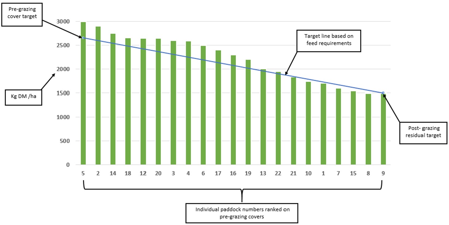
Source: https://www.dairynz.co.nz/feed/fundamentals/feed-wedges/
How the project works in practice
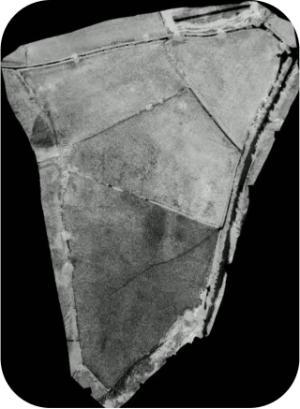 The trial was carried out on a 20-hectare grazing block, using a mix of drone technology and traditional measurements.
The drone collected:
- Multispectral images (good for picking up plant health)
- Standard RGB images (like a normal camera)
At the same time, the team still used:
- Plate meter readings
- Grass samples
- Lab analysis
- Brix readings (linked to feed quality)
All of this was used to calibrate the drone data — basically teaching it how to turn images into accurate estimates of grass cover and condition.
What was found
 The results were very encouraging:
- Drones tracked grass growth well
- They picked up when grass was grazed off
- They showed regrowth over time clearly
- Multispectral cameras gave the best results
- More accurate for measuring grass health
- But standard RGB cameras still worked reasonably well
- A working model was built for the farm
- The system can now estimate grass covers for Maesnewydd without needing constant manual measurements
In short, the drone proved it can do the job—and potentially save time in the process.
What does this mean for farmers?
If this approach is developed further, it could produce a platform/service that would:
- Cut down time spent walking fields
- Provide more detailed information across whole paddocks
- Improve grazing decisions using better data
- Make feed wedges quicker and easier to produce
Compared to measuring a few points in a field, drones can measure a whole field at once.
What next?
The project also highlighted a few challenges:
- Every farm is different
- The system works well at Maesnewydd, but other farms will likely need their own calibration
- Quality measuring is the next step
- At the moment, the focus is on how much grass is there
- The goal is to also predict feed quality from drone data which would further help farmers
- Making it easy to use
- Farmers will need simple outputs—clear numbers or graphs they can act on quickly
This project is a good example of where farming seems to be heading where there should be less guesswork and more data, but importantly this needs to be matched with better tools to support decision making with this data in a simple understandable way. They aim isn’t to replace farmers—it just gives them better information, faster.