James Ross Island
Fieldwork to James Ross Island was undertaken as part of this project, aiming to determine glacier-climate interactions on centennial to millennial times; i.e., glacier changes from the Last Glacial Maximum, through the Holocene and into the modern period. James Ross Island is separated from Trinity Peninsula (northern most Antarctic Peninsula) by the Prince Gustav Channel, which varies from 8-24 km wide. Water depths in this channel range from 400-1200m.
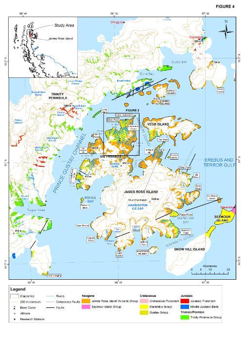
Figure 4. Map of the study region. Fieldwork was undertaken to the Ulu Peninsula, northern James Ross Island. Note the contrasting geology; granitic and metamorphic rocks crop out on the Antarctic Peninsula, whereas James Ross Island has a Cretaceous basement overlain by Neogene volcanic and glacio-volcanic rocks.
James Ross Island is a Mesozoic basin infilled with Cretaceous strata. These fossiliferous Cretaceous sandstones and mudstones are overlain by the Neogene James Ross Island Volcanic Group, which comprises basalts, tuffs, Glossary. The resistant basalt flood deltas form flat-topped mountains (‘mesas’), which are surrounded by scree.
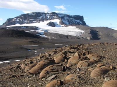
Figure 5. Lachman and San José glaciers, Ulu Peninsula. Note the flat-topped mesa, which is formed from flood basalts of the James Ross Island Volcanic Group. In the foreground the Cretaceous bedrock crops out, and the large concretions are very striking.
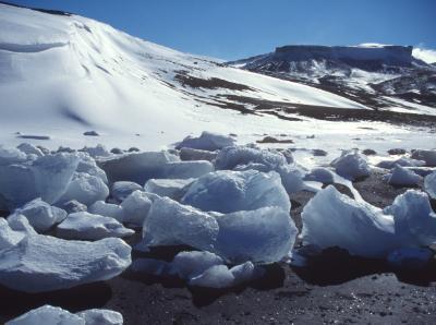
Figure 6. Mesa on James Ross Island, with ‘bergy bits’ on the beach in the foreground.
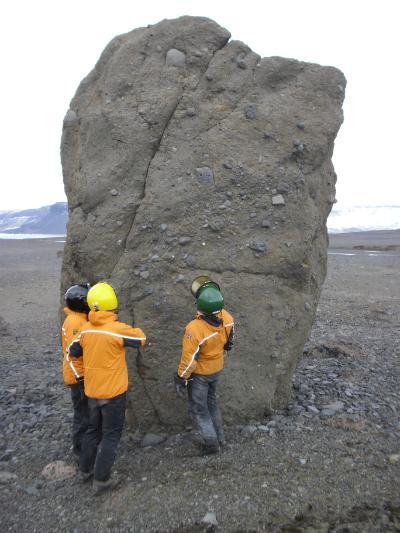
Figure 7. Neogene tillite. This is glacially-transported boulder forms part of a boulder train that stretches from Whisky Glacier to Brandy Bay.
The mountains on Trinity Peninsula contrast sharply with James Ross Island; these high peaks reach up to 1600 m above sea level. They are composed of granite and metamorphic rocks, which means that any such rocks (‘erratics’) found on James Ross Island must have originated from Trinity Peninsula.
The mountains on Trinity Peninsula form an orographic barrier, which make the western Antarctic Peninsula colder and wetter than the relatively arid James Ross Island. Aridity is a primary control on the extent of glaciers in this region.
Currently, 80 % of James Ross Island is ice-covered, and permafrost characterises the unglacierised area. The island is bounded to the southwest, south and east by high cliffs and valley glaciers. The Mount Haddington Ice Cap drains over the cliffs into outlet glaciers via avalanches and ice falls. The glaciers on James Ross Island have shown rapid retreat since observations began in the 1940s. Prince Gustav Ice Shelf was connected to the Larsen Ice Shelf until 1957; it eventually disintegrated entirely in 1995. The glacier recession in this area is generally attributed to climate warming.