Multi-scale morphological characterization and morphodynamic modelling of braided rivers
 The principle aim of this wider project is to establish a novel, computationally efficient strategy to simulate the complex feedback relationships between river flow, form and resistance that underpin the evolution of floodplains over decadal and centennial timescales. This is a vital step towards the development of broad-scale models that link floodplain evolution and related hazards to the driving forces of climate, sea-level and land-use change. Identified by theoreticians and practicioners alike as a key, but elusive goal (Brasington and Richards, 2007), such a tool will create the potential to better link, inform and contextualize local river management to the process drivers at the catchment scale.
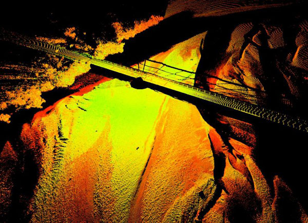
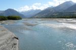
Point Cloud Obtained Using Terrestrial Laser Scanning, Rees River (New Zealand). Observations have been rendered using the intensity values. Authors: Damia Vericat and James Brasington.
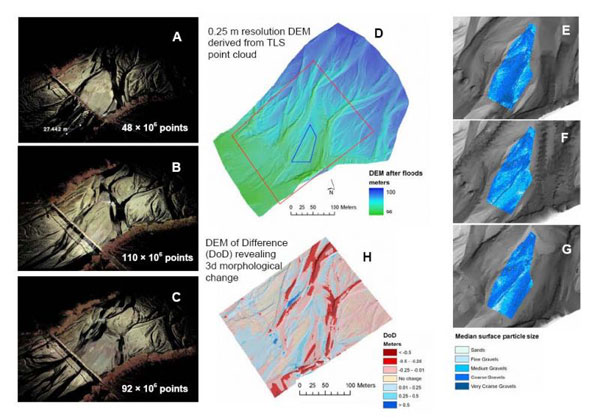
3D point clouds of the Rees River before and after 3 floods, obtained using TLS (ABC); 0.25m DEM (D); d50 in a central bar (inset on D) evolving over the 3 floods (EFG); DEM of difference of larger inset area shown on D (H).